Topographical Ltd
Land and Measured Building Surveyors
Founded in Nottingham by a Chartered Land Surveyor and Civil Engineering Surveyor, Topographical have been in business since 2017 and are regulated by the Royal Institution of Chartered Surveyors.
How it all started
Efficient and Professional
"Topographical" was initially an app-only platform for the land surveying market, launched in 2017. Providing a unique and advanced platform for clients to quote, order, pay for, download and share land surveys. This proved to be very popular with the domestic and DIY market.
Employing in-house professional "career" surveyors, we work flexibly and remotely to deliver high quality surveys which are rigorously checked and verified centrally. With a business model such as this, we were ideally positioned to weather the turmoil during the Covid years.
As we grew and developed positions on national government and commercial frameworks, we turned off a lot of the app features and reintroduced human elements because commercial projects typically have a specification produced already or require some input from the surveyors, to assist with producing the scope of works.
Keeping the best bits of our business model while growing our service offering, our underlying ethos hasn't changed: modernising the procurement and production of land and measured building surveys while upholding land surveying as a skilled profession and not a simple button pushing exercise.
Operating out of Nottingham, we typically cover a 60 mile radius for domestic projects and we operate nationally on larger and commercial schemes.
Topographic Land Surveys and Measured Building Surveys are our focus however our highly qualified and experienced surveyors do have a depth and breadth of experience in many other areas, so feel free to enquire about current capacity for less standard requests. Unfortunately we are unable to provide services in relation to boundary disputes.


Regulated by RICS
Leveraging Tech
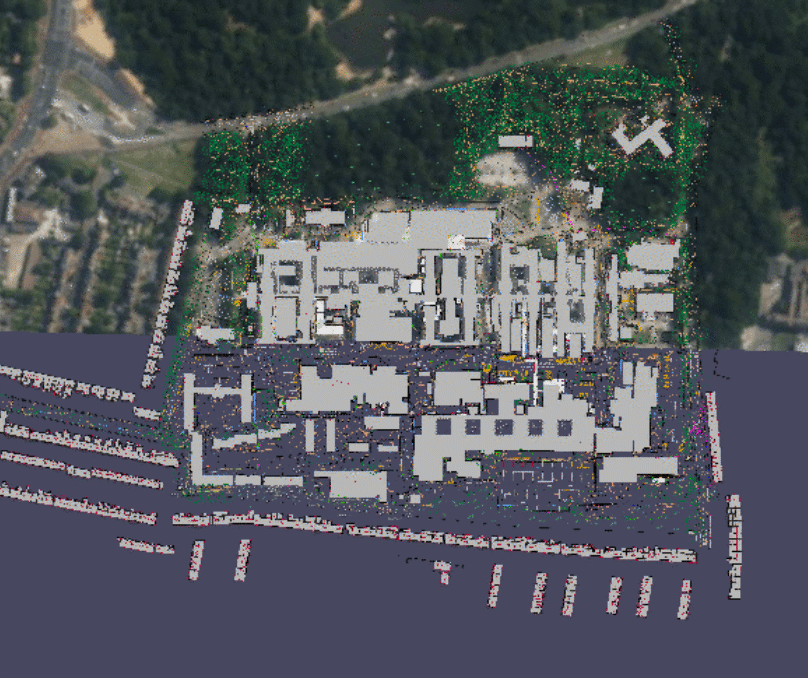
As you can probably tell, we love technology. We use top spec. equipment and software, with stringent quality controls and experienced staff. Our measurement services are utilised by a wide range of disciplines.
Planners
Site Analysis - Feasibility Studies - Zoning and Land Use - Planning Applications - Environmental Impact Assessments (EIA) - Master Planning - Stakeholder Engagement
Project Managers
Project Feasibility - Budgeting and Cost Estimation - Site Layout Planning - Regulatory Compliance - Risk Management - Construction Coordination - Progress Monitoring
Architects
Design Integration - Building Modifications - Site Layout - 3D Modeling - Accessibility Compliance - Historical Building Conservation - Construction Planning
Surveyors
Building condition surveys - Estimating costs - Structural assessments - Property valuations - Light impact assessments - Health and safety checks.
Engineers
Foundation Design - Infrastructure Design - Structural Analysis - Drainage and Water Management - Utility Placement - Slope Stability and Earthworks - Construction Support
Compliance
Land Ownership and Title Verification - Lease Agreements - Easements and Rights of Way - Development Agreements - Property Transactions - Planning and Zoning Compliance
Blog
Our latest news & views
Our blog articles are categorised as either “News” “Learn” or “On Site”. Recent posts include: -